Saturday, September 11, 2010

Tropical Update/Mannequin's Day Ruined by Fire

HURRICANES AND WEATHER
Tropical Storm Igor is strengthening again. According to the National Hurricane Center, it should be a hurricane by tonight. And, it is forecast to continue getting stronger over the next several days, turning so that the US will likely not be threatened. Meanwhile, watching a disturbance in the eastern Caribbean that has a 60% chance of becoming a tropical storm in the next couple days and a disturbance in the eastern Atlantic that has a 50% chance of becoming a tropical storm in the next couple days. Model and ensemble forecasts suggest that the eastern Caribbean disturbance will track across the Yucatan and into northern Mexico. Stay tuned.

Eastern Pacific is quiet.

Very hot and humid across the south and southeast this Saturday with thunderstorms from Texas to the Ohio Valley and over to the eastern seaboard and through the southeast. Highs in the 60s and 70s for western California, the northern states/New England (including New York and Washington D.C.).

Houston, it is just hot and sticky for no real relief in sight through the coming week. There will be some scattered showers and thunderstorms, but that's it!

SPANISH WORD OF THE DAY
Let's do fire or fuego, pronounced FWAY-goh. Find out how fuego ruined one mannequin's life in the AND MORE section.

If you are in Fort Bend County and you would like to see my award winning DVDs, Let's Learn Spanish with Frank & Paco, head to your public library. I donated several copies to the area libraries. Of course, you can always see clips on our web site. I just finished getting some music clips to put on our web site now that my Volume 3 DVD will be released soon. A CD of music from volumes 1 through 3 will be released at the same time. Volume 3 will cover the alphabet (with words beginning with those letters), numbers 1 through 20 and colors. Until it's ready for release, Let's Learn Spanish with Frank & Paco Volumes 1 and 2 on the shelf (in the education section) at Barnes & Noble stores or you can order them from http://www.frankandpaco.com, http://www.amazon.com, http://www.bn.com, http://www.bestbuy.com, or http://www.ebay.com/. Our ESL (English as a Second Language) version can be found at http://www.frankypaco.com.

AND MORE
I have long wanted to learn more about a store called Bug Time, a do it yourself extermination supply store in Stafford 4647 South Main Street (it's really the feeder road and one of the improved sections of Hwy 90). Their number is 281-565-9061. For at least a year, they have had a mannequin outside, decorated in various ways to bring attention to the shop. For the longest time, there was a male mannequin. That disappeared and was replaced by a female mannequin about 3 months ago. Now I hadn't seen the female mannequin for a couple weeks and there is a reason. Apparently, someone set fire to the truck it was placed on...ruining the truck and burning up all but the head of the mannequin. The male mannequin can't be used as a replacement as it had deteriorated due to the elements.

Owner Ron says they are debating whether or not to order a new mannequin. He said that it was their best advertising...bringing in more business than anything else. He said the nearby Dulles High School kids loved the mannequins and frequently added their own fun decorations. Ron said he would come to work in the morning only to find some new type of decoration that was clever and funny. He said one time he had removed the mannequin for a while and when he put it back, the kids put up signs saying "welcome back" and such.

So, I'll let you know if he gets a new mannequin. The suspense is almost unbearable.

On this September 11th, special prayers that God will bless our country and give comfort to all who are still suffering and grieving.

Have a great weekend everyone!
Cecilia Sinclair
Wonder Weather Woman

Wednesday, September 8, 2010

Hermine Not Done Yet/Hello Igor

HURRICANES AND WEATHER
The National Hurricane Center has issued the last advisory on Hermine. But now it is being tracked by the Hydrometeorological Prediction Center, because it still has lots of potential to dump flooding rains. Speaking of rain totals, Georgetown and much of Austin picked up a foot or more of rain. Houston had some 3+ totals but handled it well.

Meanwhile, Tropical Storm Igor has formed in the far eastern Atlantic. Model predictions mostly suggest a turn to the north at some point. Will watch. Too soon to tell for sure.

Two other disturbed areas are being watched including what is left of Gaston now in the Caribbean. The National Hurricane Center says nearly a 0% chance of that developing in the next couple of days. Will keep watching.

Tropical Pacific is quiet.

Slight risk for severe storms for the western northern plains on Thursday. Many areas of the country will also have thunderstorms and flooding rains will threaten the nations mid-section as the remnant of Hermine track northeastward.

Houston will be muggy will only a scattered showers or thunderstorms into the weekend. Long range looks continued warm with some very slightly drier air next week...don't get your hopes up...will still be muggy.

SPANISH WORD OF THE DAY
Let's do book or libro, pronounced LEE-bro. Find out about 2 books I really endorse in the AND MORE section.

Getting some music clips to put on our web site now that my Volume 3 DVD will be released soon. A CD of music from volumes 1 through 3 will be released at the same time. Volume 3 will cover the alphabet (with words beginning with those letters), numbers 1 through 20 and colors. Have had a few of Sarah's friends checking out the rough draft of Volume 3 and they were glued to the set. Until it's ready for release, you can order my award winning DVDs, Let's Learn Spanish with Frank & Paco Volumes 1 and 2 on the shelf (in the education section) at Barnes & Noble stores or you can order them from http://www.frankandpaco.com, http://www.amazon.com, http://www.bn.com, http://www.bestbuy.com, or http://www.ebay.com/. Our ESL (English as a Second Language) version can be found at http://www.frankypaco.com.

AND MORE
Today is the 110th anniversary of the Great Galveston Storm of 1900, the worst weather disaster in US history--as many as 12,000 deaths. There were a lot of parallels between Hurricane Ike of 2008 and that storm. Now, I am reading a fascinating book filled with Ike anecdotes and flashbooks to the 1900 Storm and all kinds of interesting connections. It is called Infinite Monster by Leigh Jones and Rhiannon Meyers. Thanks to my buddy and hurricane historian, Lew Fincher, owner of Hurricane Consulting, for giving me the book.

Speaking of books and in honor of Rosh Hashanah, I am also recommending a book called The Lost Cellos of Lev Aronson by Frances Brent. I just finished the book about Lev Aronson, an accomplished cellist, who suffered greatly through the Holocaust. It's a great read and I can't stop thinking about all he endured. May we never forget!

Have a terrific Thursday everyone!
Cecilia Sinclair
Wonder Weather Woman

Tuesday, September 7, 2010

Flood and Tornado Threat Update Tuesday Morning 9/07

Hello everyone -
Rain from the weakening Hermine is bringing a threat of flooding for the next 2 or 3 days. As I write this post this morning, I have not seen any reports of tornadoes, but that could change. The biggest concerns right now are possible tornadoes and flooding.

FLASH FLOOD WATCH THROUGH WEDNESDAY MORNING 9/08

The following is the advisory from the National Weather Service. Please keep in mind that I am posting this on Tuesday morning. The watch area and timing will likely be modified over the next day or so. Please consult the Houston/Galveston National Weather Service office for the very latest updates.

THE FLASH FLOOD WATCH IS NOW IN EFFECT FOR

* A PORTION OF SOUTHEAST TEXAS...INCLUDING THE FOLLOWING
COUNTIES...AUSTIN...BRAZORIA...COLORADO...FORT BEND...
GALVESTON...HARRIS...JACKSON...MATAGORDA...WALLER AND WHARTON.

* THROUGH WEDNESDAY MORNING

* THE REMNANTS OF TROPICAL STORM HERMINE WILL CONTINUE TO MOVE
SLOWLY ACROSS SOUTH TEXAS THIS MORNING AND THEN INTO WEST
CENTRAL TEXAS BY EARLY WEDNESDAY. THE WIDESPREAD PRECIPITATION
OVER SOUTH CENTRAL TEXAS IS EXPECTED TO MOVE INTO SOUTHEAST
TEXAS TODAY AND TONIGHT. LOCALLY HEAVY RAIN AND TRAINING CELLS
ARE LIKELY. EXPECT WIDESPREAD 1 TO 3 INCH RAINFALL AMOUNTS
THROUGH TONIGHT WITH THE POTENTIAL FOR SOME AREAS TO EXPERIENCE
5 TO 10 INCHES WHERE TRAINING PRECIPITATION OCCURS.

TORNADO WATCH
The following is the advisory from the National Weather Service. Please keep in mind that I am posting this on Tuesday morning. The watch area and timing will likely be modified over the next day or so. Please consult the National Weather Service/Storm Prediction Center for the very latest updates.

The National Weather Service has issued a Tornado Watch effective until 1 pm Tuesday 9/07 for the following counties:

TEXAS COUNTIES INCLUDED ARE

ARANSAS AUSTIN BEE
BRAZORIA CALHOUN COLORADO
DEWITT FAYETTE FORT BEND
GOLIAD GONZALES JACKSON
JIM WELLS KARNES KLEBERG
LAVACA LIVE OAK MATAGORDA
NUECES REFUGIO SAN PATRICIO
VICTORIA WALLER WASHINGTON
WHARTON

Be safe everyone!
Cecilia Sinclair
Wonder Weather Woman

Monday, September 6, 2010

Tropical Storm Hermine/Flash Flood Watch/DQ Mini-blizzard

HURRICANES AND WEATHER
Tropical Storm Hermine is strengthening in the southern Gulf, but it doesn't have much time to strengthen as it should make landfall tonight over northern Mexico or southern Texas. Bottom line...there is going to be a lot of rain. A vast area is under a flash flood watch including the following portion of Houston. The following is the Monday morning advisory from the Houston National Weather Service. Please understand that the watch area and duration will likely change over the next couple of days. So be sure to check with the local media and the Houston National Weather Service for the very latest advisories.

FLASH FLOOD WATCH IN EFFECT FROM THIS EVENING THROUGH TUESDAY
EVENING...

THE NATIONAL WEATHER SERVICE IN HOUSTON/GALVESTON HAS ISSUED A

* FLASH FLOOD WATCH FOR A PORTION OF SOUTHEAST TEXAS...INCLUDING
THE FOLLOWING COUNTIES...AUSTIN...BRAZORIA...COLORADO...FORT
BEND...JACKSON...MATAGORDA AND WHARTON.

The watch means that conditions are favorable for heavy rain. Once flooding is occurring or imminent, the National Weather Service will issue Flash Flood Warnings. Once that happens, you should avoid driving and stay at home unless advised to do other wise.

Elsewhere in the Tropical Atlantic, still watching the remnant of Gaston which could become a tropical storm again within the next 2 days as conditions are favorable for that.

Tropical Pacific is quiet.

Houston, heaviest rain will be early Tuesday through Wednesday but there could be scattered showers and thunderstorms thereafter through the coming weekend.

In the nation the Labor Day, many locations will have thunderstorms and there is a slight risk of severe storms for Minnesota, Wisconsin, and Iowa.

SPANISH WORD OF THE DAY
Let's do rain or lluvia, pronounced YOU-vee-ah. There will be a lot of lluvia in Texas this week.

Volume 3 will be released soon. Volume 3 will cover the alphabet (with words beginning with those letters), numbers 1 through 20 and colors. Have had a few of Sarah's friends checking out the rough draft of Volume 3 and they were glued to the set. Until it's ready for release, you can order my award winning DVDs, Let's Learn Spanish with Frank & Paco Volumes 1 and 2 on the shelf (in the education section) at Barnes & Noble stores or you can order them from http://www.frankandpaco.com, http://www.amazon.com, http://www.bn.com, http://www.bestbuy.com, or http://www.ebay.com/. Our ESL (English as a Second Language) version can be found at http://www.frankypaco.com.

AND MORE
Mini-blizzard at DQ
I love the mini-blizzard size at Dairy Queen (DQ)...just the right size for portion control. I think the price is a bit high...$2.29 at the DQ we go to. Speaking of that, I was interested in how they grouped the choices for blizzards...4 groups. Which type is your favorite? Put in your vote in my new poll at right. Only one answer is allowed. Thanks in advance for participating.

Magic Exhibit Coming to an End
This is the last weekend to see the Magic exhibit at the Houston Museum of Natural Science. If you are looking for something to do with the kids, I heard it is not to be missed.

Baylor College of Medicine Visit with Medical Students
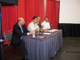
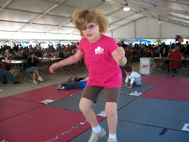
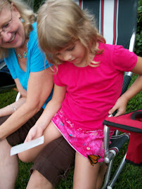
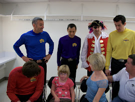
Thursday, Sarah joined Gordy and me giving a talk to the Baylor College of Medical Students as part of their genetics lecture series. We were joined by two families with adults with Williams Syndrome and one with a little girl, Emma, with velo-cardio-facial syndrome (VCFS). See photo at right and here is the link:
http://vcfsef.org/
VCFS is the 2nd most common syndrome after Down Syndrome. Yet, it is way underdiagnosed. I have written about it previously in my blog--about a year ago.

We were there to speak about living with Smith-Magenis Syndrome (SMS). For more information, go to prisms.org. Thankfully, our experience has been much easier than that of most families.

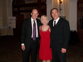
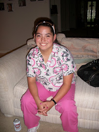
Sarah formed a new friendship with medical student, Chaya (see right), who said that she went to the same elementary school that Sarah is attending now. And she had the teacher who is now Sarah's principal. Small world! Good luck in your studies Chaya.

Special thanks to Dr. Lorraine Potocki, her assistant Valerie Price and all the wonderful people at Baylor Genetics for helping to enlighten the next generation of doctors. Interestingly, at our last appointment with Sarah's immunologist, there was a young doctor assisting who said that he remembers us giving the lecture to students when Sarah was a toddler.

Hi-Rise Truck
Just had to share this photo I snapped of a high rise truck...this is one of the highest I have ever seen.

Be safe with the heavy rain everyone. Remember, turn around, don't drown. Never cross a flooded roadway on foot or in a car.

Cecilia Sinclair
Wonder Weather Woman

Sunday, September 5, 2010

Tropical Depression #10 and Wet Week Ahead for TX

Hello Everyone -
Just a quick update this evening as Tropical Depression #10 has formed in the southern Gulf. It may become Tropical Storm Hermine before moving into Mexico. East Texas will be on the wet side of the flow around this system so more than anything, it looks like much of Texas including Houston area will get drenched this week--especially Tuesday and Wednesday.

More to come!

Cecilia Sinclair
Wonder Weather Woman

Wednesday, September 1, 2010

Watching Gaston/Labor Day Weekend Forecast

HURRICANES AND WEATHER
3 named storms in the Atlantic and possibly a 4th named Hermine in a few days.

Most immediate concern is Earl, a Category 4 hurricane which might hit the outlying areas of the eastern seaboard on Thursday and southern New England on Friday. I am reminded of a great book called Sudden Sea about the 1938 storm that slammed into eastern Connecticut and Rhode Island.

Fiona is not forecast to become a hurricane but it could pass very close to Bermuda.

Finally, I am watching Gaston, pronounce ga-STAWN which is forecast to become a hurricane on Friday and move westward. Long range steering environment could bring it into the Gulf middle of next week. So stay tuned.

Slight risk for severe storms on Thursday from northern Texas to southern Wisconsin. Very hot in the desert Southwest with lots of 100+ readings. Hot and sticky across the south and southeast with highs in the 90s. Very pleasant for most of the west coast, Rockies, central and northern plains and New England with highs in the 60s and 70s and low humidity.

Big trough which will steer Earl northward will also usher an early September "cold" front into Houston late Friday. Lower humidity air arrives in advance--early Friday. But the big improvement will be late Friday and through Sunday. Should be a very pleasant weekend with mild mornings and warm afternoons with low humidity. Look for some rain to return as early as Labor Day Monday and scattered storms Tuesday and Wednesday.

SPANISH WORD OF THE DAY
Let's do hot or caliente, pronounced cah-lee-EHN-tay. It sure has been caliente this summer. See my global warming poll results in the AND MORE section.

Volume 3 will be released soon. Volume 3 will cover the alphabet (with words beginning with those letters), numbers 1 through 20 and colors. Have had a few of Sarah's friends checking out the rough draft of Volume 3 and they were glued to the set. Until it's ready for release, you can order my award winning DVDs, Let's Learn Spanish with Frank & Paco Volumes 1 and 2 on the shelf (in the education section) at Barnes & Noble stores or you can order them from http://www.frankandpaco.com, http://www.amazon.com, http://www.bn.com, http://www.bestbuy.com, or http://www.ebay.com/. Our ESL (English as a Second Language) version can be found at http://www.frankypaco.com.

AND MORE
My poll on global warming is closed. 50% said they thought manmade global warming is causing the extreme record heat. 0% said they thought naturally occurring global warming is causing the exreme record heat. And 50% said they were not sure what the cause is. Only one answer was allowed. Thanks to all who participated. I hope to have a new poll in my next post.

Have a terrific Thursday everyone.
Cecilia Sinclair
Wonder Weather Woman

Monday, August 30, 2010

Labor Day Weekend Forecast/Tropical Update/"New" Wardrobe - No Money

HURRICANES AND WEATHER
In the Atlantic, Danielle is weakening while Earl is forecast to become a major hurricane in the next day. Earl is passing the northeastern Leeward Islands and it is still not clear if it will not hit the U.S. Most models show it missing, but we still need to watch it carefully from the Carolinas to the the coastal New England states. Next disturbance in the central Atlantic will likely become Fiona, but it is less likely (at this point) than Earl to threaten the U.S.


In Eastern Pacific, there is an area of disturbed weather with a slight chance of becoming a named storm in the next 2 days.

Some severe weather is possible today over the northern and central plains. That area shifts eastward on Tuesday. Very hot and steamy across the northeast, east and south today with highs in the 80s and 90s. Pleasant for coastal California, Pacific Northwest and northern Rockies and northern Plains with highs in the 60s and 70s.

Houston, we are back to mega hot and sticky all week. Some dry air arrives late Friday and Saturday will be more comfortable. Look for scattered showers and thunderstorms each afternoon this week. Labor Day weekend, a slight chance for a stray storm on Sunday and t-storms slightly more likely on Monday.

SPANISH WORD OF THE DAY
Let's do buckle or abrochar, pronounced ah-bro-CHAR. What is the safest way abrochar your child in the car. See the AND MORE section.

Finished all art work for Volume 3 and now just a few more finishing touches on the editing. Volume 3 will cover the alphabet (with words beginning with those letters), numbers 1 through 20 and colors. Have had a few of Sarah's friends checking out the rough draft of Volume 3 and they were glued to the set. Until it's ready for release, you can order my award winning DVDs, Let's Learn Spanish with Frank & Paco Volumes 1 and 2 on the shelf (in the education section) at Barnes & Noble stores or you can order them from http://www.frankandpaco.com, http://www.amazon.com, http://www.bn.com, http://www.bestbuy.com, or http://www.ebay.com/. Our ESL (English as a Second Language) version can be found at http://www.frankypaco.com.

AND MORE
Get "New" Clothing Without Shopping
I'm cleaning out my closet for one of those charity pick-ups. This time I am determined to be ruthless. Get rid of everything I don't wear...no holding back!!! And, I change things around. Moving tops to a location in the closet that is more accessible. Look down on the floor and big bonus, I find 4 tops on the ground. One of them, I thought I had lost on a trip. One I had been trying to find for a while. And two I had completely forgotten about but really loved!!! I have a whole new wardrobe this Monday morning and didn't spend a dime. And, since I am keeping track of what I am giving to charity, I'll have a nice charity deduction come April 15th.
Ahhhhhhhhhhhhhhhhhh, so rejuvenating!!!

Keep Your Kids Safe in the Car
My sister has 3 little ones and recently asked me about putting her oldest in a booster. Then, I'm driving home and see a billboard for bucklethemright.org. So I check it out and it goes right to the Texas click it or ticket site. There is lots of great information including a clarification of the child safety seat law in Texas. Here is a summary from the site.

Texas is doing its part by requiring every passenger in a vehicle to wear a safety belt. If a rider isn't buckled in, they'll receive a citation. What's more, if a child passenger younger than 8 years old (unless taller than 4 feet, 9 inches) is not buckled up or is buckled in wrong, the driver will be ticketed.

They have information about where you can go to make sure you are buckling your little ones correctly and much more. Here is the link:
http://texasclickitorticket.com/child_safety.html

Rolling Blackouts
We have been having rolling blackouts in the Sugar Land area for a week...but there is nothing on the Centerpoint web site. I called and unquired and they had nothing to say, except they will have someone come out and check our grid. Do they truly not know that there have been rolling blackouts? Do they think that not saying anything will make us not notice? Have any of you been having any regular trouble? I have lived here 10 years and this is the first time I recall this happening in non-severe weather. Will let you know if I find anything out.

Katrina Anniversary
As we mark the anniversary of Hurricane Katrina, let us continue to keep all victims of that storm and all natural disasters in our prayers. I'll never forget the family our church assigned to our group of families or the single mom with a grown disabled son who was completely uprooted from a life that was working. Let us never be too busy to lend a helping hand.

Have a great week everyone!
Cecilia Sinclair
Wonder Weather Woman